What are Ground Control Points (GCPs)?
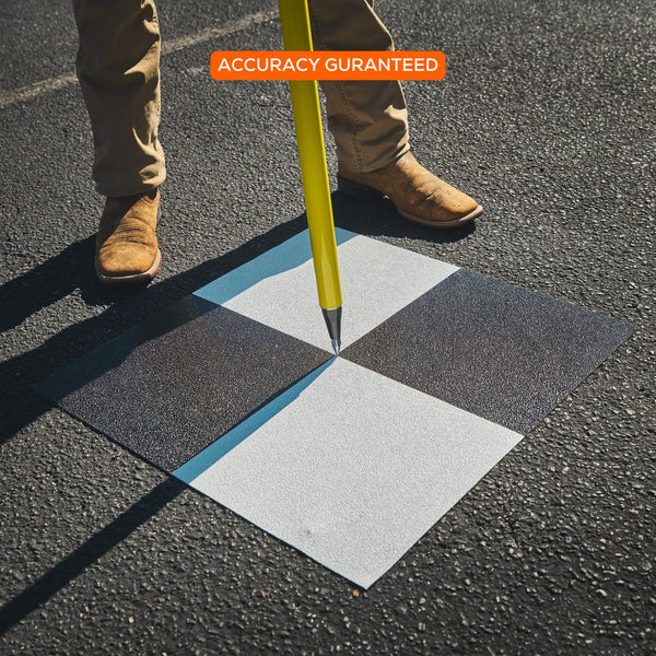
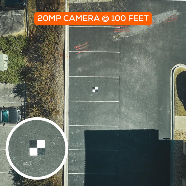
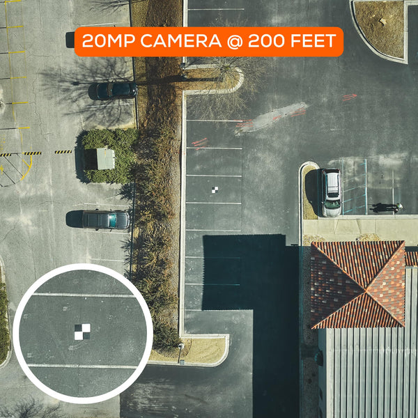
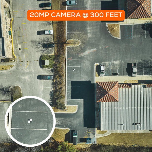
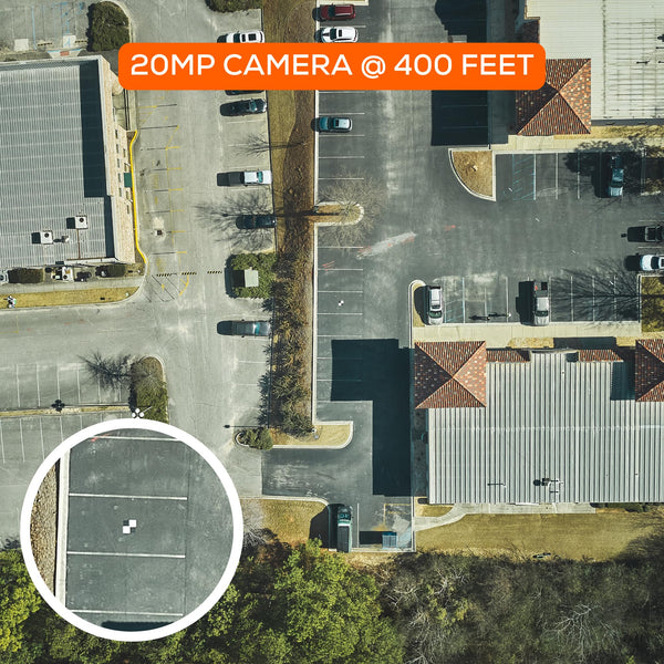
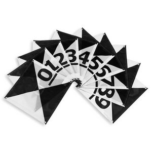
Ground Control Points (GCPs), such as those provided by SkyHighBullseye, significantly reduce errors in drone GPS data, ensuring precise georeferencing of aerial images with high-precision instruments like RTK GPS, achieving centimeter-level accuracy. These points are marked by highly visible targets and distributed strategically to serve as a reference framework, facilitating the integration of drone data with geospatial datasets & GIS systems. Incorporating GCP coordinates into photogrammetry software is crucial for correcting positional errors in drone imagery. Essential for generating accurate 3D models, GCPs support detailed mapping in agriculture, construction, urban planning, and archaeological studies, as well as assisting scientists and conservationists in environmental monitoring.
TESTIMONIALS
Very efficient and easy to use for any job requiring GCP's. Does come with eyelets for stakes, however the material is heavy enough that I do not find myself needing to stake them down.
Amazon.com
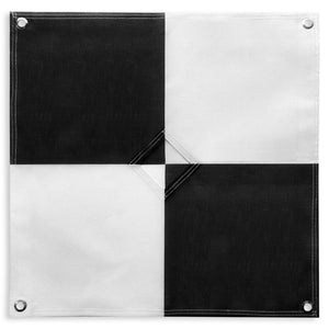
These targets are a much, much better material than the traditional vinyl ones. They are a mesh material and therefore allow for some wind to blow right through them making them easier to deploy and stay in position. They are also breathable unlike the vinyl. This is nice for when condensation forms underneath the target and you have to put them away wet. They feel very durable and hefty with a very low chance of ripping and should last much longer. The metal grommet in the center is a nice touch for placing the survey rod. 10/10 would buy again.
Amazon.com
After using these ground control points for a couple of jobs, they have earned a place in my work truck. These are easy to put down and work very well. They are quite visible on the drone imagery, and show well in Pix4D when marking!
Amazon.com
Ground Control Points For Surveying
If you consider the cost of the materials and labor required to make DIY GCPs, we are confident that our ground control point targets are actually more cost-effective than most DIY options. Your time should be spent in the field and on your workstation creating deliverables for your clients, not making GCPs.
We've got your GCP needs covered. If you aren't 100% satisfied with our ground control points, we'll refund you 110% of the purchase price - no questions asked. We're confident that our control point surveying targets will work accurately.

Software Compatibility
Compatible with Pix4D, Reality Capture, DroneDeploy, Agisoft Metashape, and more


Ground Control Points For Drone Mapping & Surveying
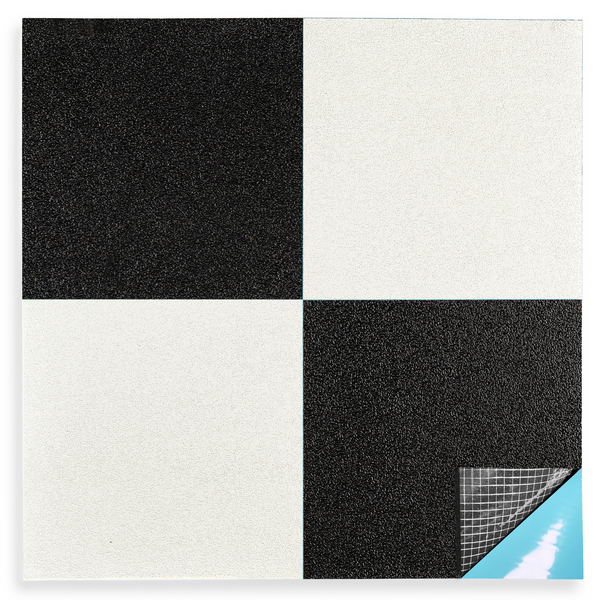
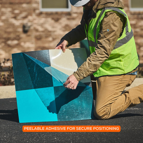
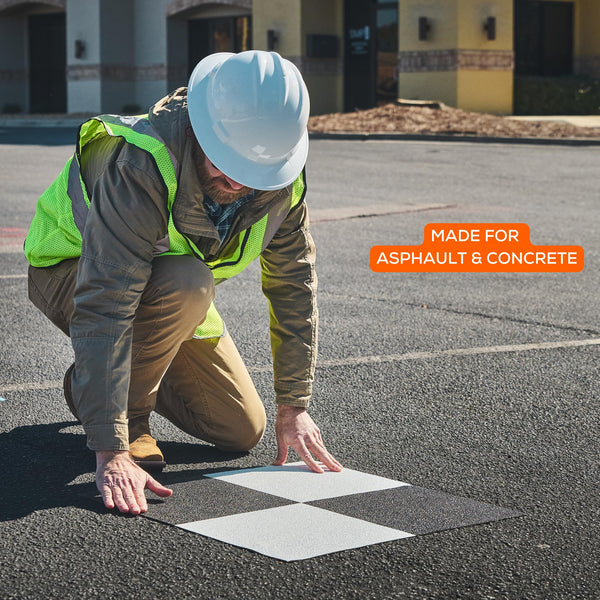
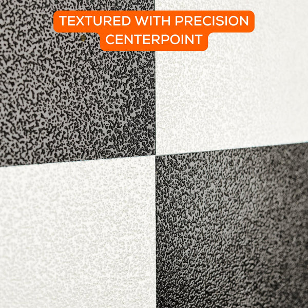
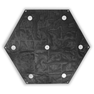
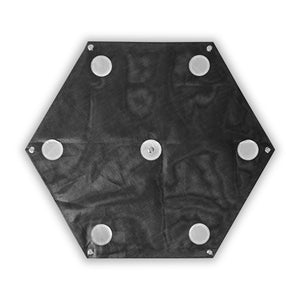
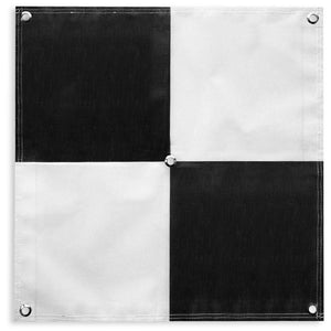
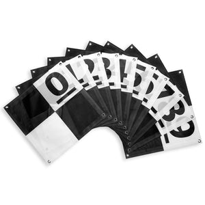
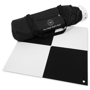
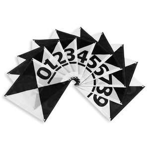
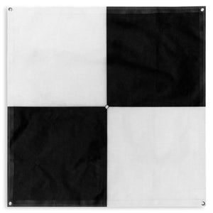
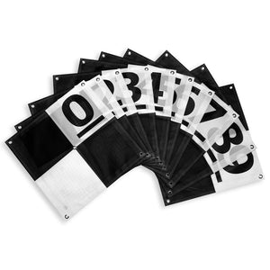
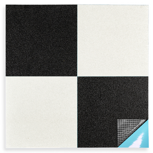
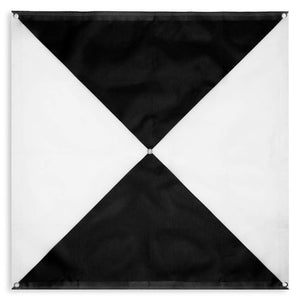
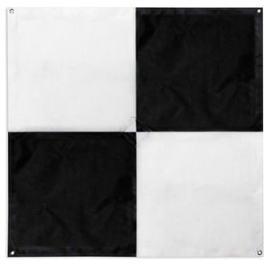
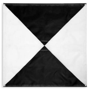
At Sky High Bull’s-Eye, we specialize in making ground control points for drone mapping. Our drone mapping equipment is specifically designed for surveyors and drone pilots specializing in UAV aerial survey missions. The drone GCP targets that we produce are made of a matte, vinyl mesh material that is durable and weatherproof while also being antireflective – perfect for mapping missions in all types of weather environments. Our control points for surveying are available in 24” x 24” and 48” x 48” sizes in both the checkerboard and iron cross patterns. When selecting aerial targets for aerial mapping projects, we hope you will consider Sky High Bull’s-Eye as your drone GCP provider of choice!
OUR PARTNERS